East Carolina University 2008 Fall Field School Methodology Gallery
Data Recovery
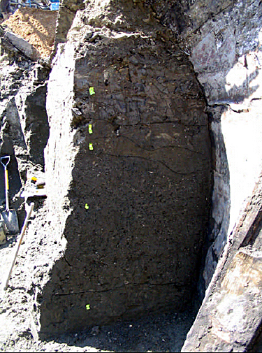
Soil profiles from sediment block. The yellow tags indicate different soil layers.
When discoveries were encountered, they were fenced with yellow caution tape, and the excavation shifted to another location while archaeologists began data recovery. Initial exposure involved excavation using mechanical means, such as an excavator, to remove sterile soils. Once cultural soils were encountered, profiling and screening of the surrounding matrix was used to determine depositional history. Structural remains were exposed in their entirety, digitally photographed, and mapped in situ. Soil color and texture samples were recovered and soil profiles were drawn when appropriate. Diagnostic artifacts were recovered, bagged, labeled with provenience data, and later cleaned and culled on site, before being transferred to the WSA conservation lab, where they were catalogued.
During excavation of the ships hull, a soil column of sediment on the port side of the stern was kept intact in order to provide a profile of the surrounding bay mud and historic fill. This profile indicated that the ships hull was embedded in at least four feet of bay mud.
Previous Next